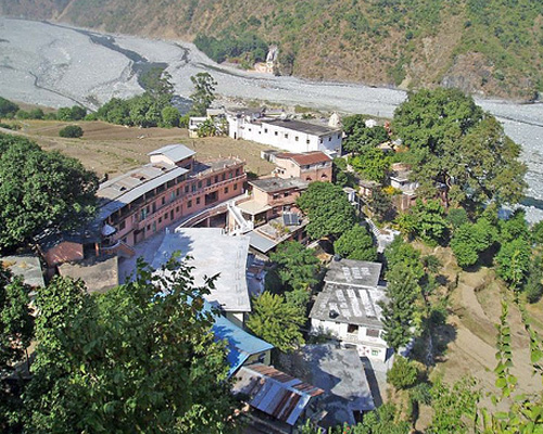
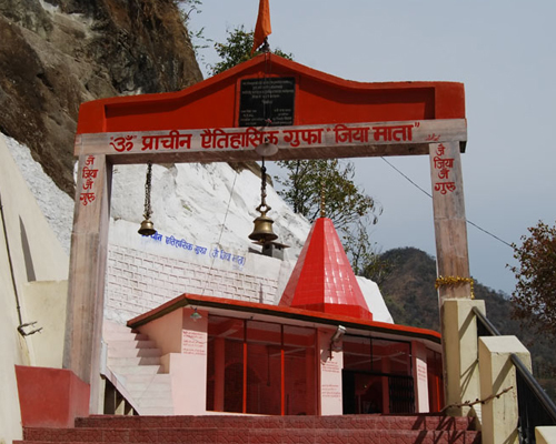
covers a quite big area including three different levels, the main Ashram, Fakirabad and the Gufa Side. This upper plan shows the upper floor, where You arrive and where the office, the main temple and most of the rooms are located. There are also 5 guest houses and the Bhakti Bhandar Shop , the main temple, the Italian temple and Sri Babaji‘s Kutir and the Sri Baba Research Hospital where both Ashram visitors and local people are treated. According to “The Teachings of Babaji,” Haidakhan Babaji “appeared” in June 1970 in a cave at the foot of the Kumaon Mount Kailash, across the river Gautama Ganga, near a remote village called Hairakhan, in the Nainital District of Uttrakhand, India. His followers maintain that Haidakhan Babaji is a Mahavatar – “a human manifestation of God, not born from woman.” It is reported that starting in late September 1970 Haidakhan Babaji (हैडाखान बाबाजी) spent forty-five days meditating in a small temple on the top of the Kumaon Mount Kailash “without leaving his seat.” In September 1971, Haidakhan Babaji, in a sworn testimony, convinced the judge of the court in Haldwani that he was the “Old Hairakhan Baba,” thought to be active in that region in the years 1860–1922, and that he had the right to use the ashrams in Kathgaria and Haidakhan. In 1971 Haidakhan Babaji started travelling across India, proclaiming his Message, performing sacred ceremonies, such as yagna, and attracting more devotees. This included celebrities, such as Shammi Kapoor, and gradually more Westerners.
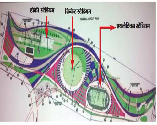
Haldwani, which will host the 38th National Games in 2018, is expected to be completed by March 2016. Construction work on the international sports stadium was earlier delayed as there were hurdles in acquiring an additional 12 hectare of forest land that was required for the facility. Akhtar Ali, assistant sports director, Kumaon division said, "The process for land transfer has been completed. We expect the stadium to be completed by March 2016." Spread over 30 hectare, the stadium will have cricket and football grounds, a track for 800 meter race, a hockey field, badminton courts, a lawn tennis court, a boxing ring and a swimming pool. A hostel for 150 sportsperson will also be built inside the stadium premises. The multi-purpose sports facility is the first of its kind in the hill state. After a long period of announcement of “International Stadium” in Golapar, Uttarakhand , State Government of Uttarakhand has approved it finally. This has land to hike in property prices in Golapar, Investors started purchasing bhigas of land in past few years were waiting for Stadium’s approval, after its approval they are making huge profits on selling their properties.The stadium will be first of its kind in Asia with biggest in size.
Kathgodam is a town in the Nainital district of Uttarakhand state of India. It is part of the twin township of Haldwani-Kathgodam, and is immediately north of Haldwani. It is one of the important collection centres for forest products obatained from Kumaon Himalayas. Kathgodam is a town that is present in the Nainital district in the state of Uttarakhand. The town serves as the entry point to many of the tourist destinations in the state. There are many places of interest that can be seen in the town and it is famous for its numerous beautiful temples. The temples dedicated to Sheetla Devi and Kalichaud attract many pilgrims and devotees from many of the nearby regions, and this is especially true during the festival season. The town of Kathgodam experiences a mild and temperate climate for most months of the year. The conditions are cool and a cool breeze can be experienced from the surrounding mountains. The summers here are never extreme, even during the peak summer months. The winters can be extreme with temperatures approaching the freezing point frequently. The summer season is from April to June. The conditions are cool for the most part as the temperatures rarely rise beyond the 30°C mark during the summer season. The lowest temperatures that you can expect during the summer months are around 15°C. The place does not receive significant amount of rainfall and the entire region is generally considered to be dry during the monsoon season. The limited rainfall that can be seen in the region is predominantly during the months from July to September. Temperatures are cool and this is a good time to visit the place. The months of October and November are also pleasant. The winter season is from December to February. The temperatures range from a minimum of 0v and can be expected to climb to around 24°C during the winter months. The coldest month is usually January.
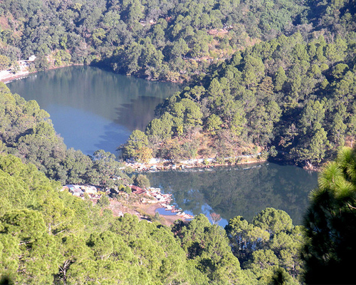
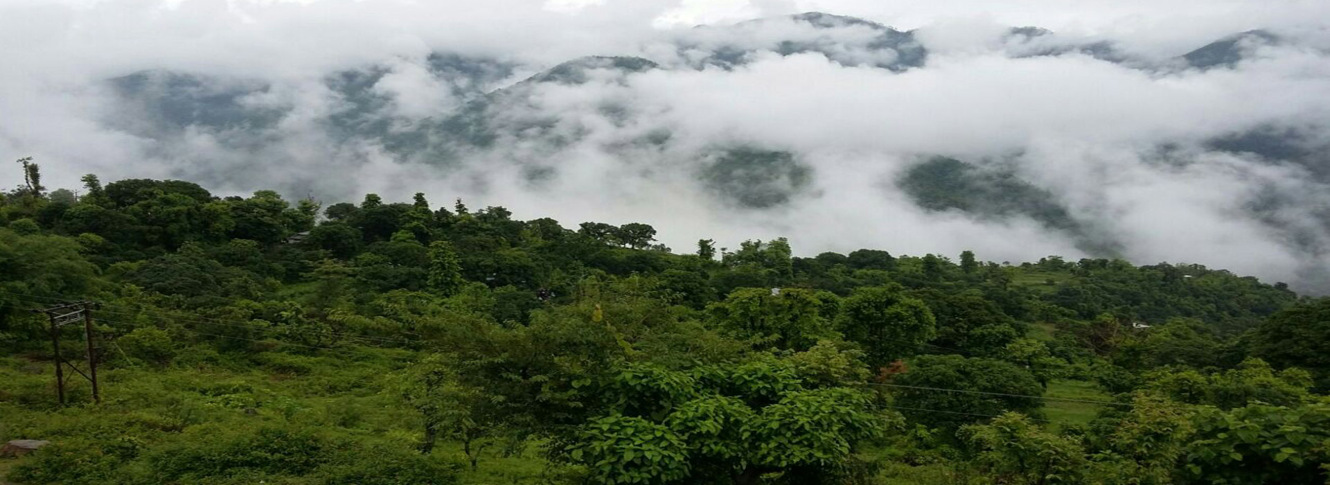
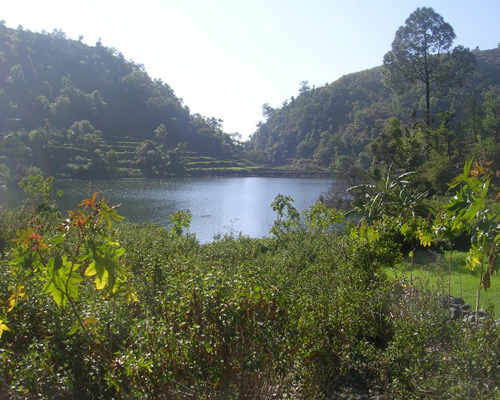
Sat Tal (Hindi for "seven lakes") is an interconnected group of seven freshwater lakes situated in the Lower Himalayan Range near Bhimtal, a town of the Nainital districtin Uttarakhand, India. During the British Raj, the area had a tea plantation, one of four in the Kumaon area at that time. The lakes sit at an altitude of 1370 metres below lush orchards in the Mehragaon valley. Set amongst dense forests of oak and pine trees, Sattal is one of the few unspoiled and unpolluted freshwater biomes in India. These lakes are a paradise for migratory birds. It is home to a few camps being operated mostly by local people catering to tourists looking for outdoor vacations.
Eight kilometers north of Haldwani at Ranibagh is Chitrashila Ghat, the venerable Hindu cremation ground. A fair called Uttarayani (also called Ghughutiya in Kumaoni) is held here on Makar Sankranti (on 13-14 of January) every year.
Long in the shadow of its famous hill cousins, the Haldwani has a lot to offer by the way of quaint villages, rolling deciduous forests and open spaces outside the urban sprawl. Today Haldwani has got sports stadium, bus terminals, shopping malls, Public schools, Technical institute, Coaching centers, and such paraphernalia being commercial hub in the Foothills. The last 20 years have seen an explosion in the demographics leading to a expanding boundaries of the city which has its sobriquet of "Green City" till now. In 1816, after the British defeated Gorkhas, Gardner was appointed the Commissioner of Kumaon. Later George William Trail took over as Commissioner and renamed Halduvani as Haldwani in 1834. Though British records suggest that the place was established in 1834, as a mart for hill people who visited the Bhabhar (Himalayan foothills) region, during the cold season. Mughal historians mention that in the 14th century, a local ruler, Gyan Chand of Chand Dynasty, visited Delhi Sultanate and received the regions of Bhabhar- Terai up to the Ganges as a grant from then Sultan. Later, the Mughals tried to take over the hills, but their attempts received a setback due to the difficult terrain.
Harish Tal is a Village in Okhalkanda Tehsil in Nainital District of Uttarakhand State, India. It is located 45 KM towards East from District head quarters Nainital. 18 KM from Okhalkanda. 247 KM from State capital Dehradun
Harish Tal Pin code is 263126 and postal head office is Kathgodam.
Harish Tal is surrounded by Dhari Tehsil towards North , Pati Tehsil towards North , Haldwani Tehsil towards west , Bhimtal Tehsil towards west.
Haldwani , Champawat , Sitarganj , Nagla are the nearby Cities to Harish Tal.
Demographics of Harish Tal
Hindi is the Local Language here.
HOW TO REACH Harish Tal
By Rail
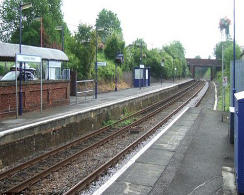
There is no railway station near to Harish Tal in less than 10 km. How ever Kathgodam Rail Way Station is major railway station 29 KM near to Harish Tal
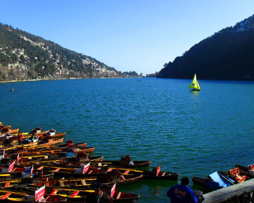
Ringed by the seven hills Nainital (नैनीताल) lies the enchanting and sacred Naini (नैनी) lake. Named after the legend proclaiming that the left eye of Parvati, consort of the Lord Shiva fell here, this is where the Naina Devi Temple now stands. Nainital is also mentioned in the ‘Manas Khand’ as Tri-rishi Sarovar. According to this gatha, three sages, Atri, Pulastya and Pulaha, chanced upon this place while on pilgrimage and feeling thirsty, summoned the waters of the Mansarovar Lake. Today Nainital still retains its religious significance, but has also become a treasured holiday destination for people from around the world. It is believed that the Naini Lake is one of the 64 Shakti Peeths, or religious sites where parts of the charred body of Sati (Parvati) fell on earth while being carried by Lord Shiva. The spot where Sati’s eyes (or Nain) fell, came to be called Nain-tal or lake of the eye. The goddess Shakti is worshiped at the Naina Devi Temple on the north shore of the present day lake.
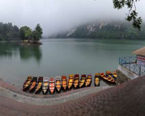
Bhimtal (भीमताल) is a town in Nainital (नैनीताल) district in the state of Uttarakhand (उत्तराखण्ड), India situated at an altitude of 1370 meters above sea level and is about 22 kilometers from Nainital. The major attraction in Bhimtal is the Bhimtal Lake which has an island at its centre. Bhimtal is an ancient place named after Bhima of Mahabharata. Bhimeshwara Mahadev Temple, an old Shiva temple in the bank of Bhimtal lake, is believed to have been built when Bhima visited the place during the banishment (vanvas) period of Pandavas (पाण्डव) . The major attraction in Bhimtal is the Bhimtal Lake, which has an island at its centre. Besides tourism, Bhimtal has also now become a mini district headquarters since most of the district administration offices have been shifted to the newly constructed Vikas Bhawan, the building complex for district administrative offices. Bhimtal is an ancient place named after Bhima of Mahabharata. Bhimeshwara Mahadev Temple (भीमेश्वर महादेव मंदिर), an old Shiva temple in the bank of Bhimtal lake, is believed to have been built when Bhima visited the place during the banishment (vanvas) period of Pandavas.
© Copyright 2016, Roshila Village. Designed by Unikudos Softwares